Coan Hall Geophysics
Northumberland County, Virginia
University of Tennessee - Knoxville | Coan Hall Archaeological Research Group (CHARG)
Since 2018, I have been collaborating with Dr. Barbara Heath at the University of Tennessee-Knoxville (UTK) and the Coan Hall Archaeological Research Group (CHARG) to develop a better understanding of the colonial-era landscape using geophysical survey. The site is the location of ongoing archaeological research into the nature of colonial entanglements between Indigenous groups and English colonists on Virginia’s Northern Neck.
Site Overview
The Coan Hall site, located on Virginia’s Northern Neck in Northumberland County, is home to the seventeenth century plantation of John Mottrom. The site has been the location of numerous historic, and likely pre-contact occupations, spanning from the late Woodland period to the twentieth century. First discovered by Stephen Potter in the 1960s and systematically surface collected by him as part of his dissertation research in the 1970s, this site has more recently been the subject of field investigation by the University of Tennessee-Knoxville. Under the direction of Dr. Barbara Heath, fieldwork began with initial testing in 2011 and with intensive excavations beginning in 2015. These excavations have uncovered portions of a circa-1640s 54 x 21.5 ft. earthfast manor house, a series of pits, some of which are likely associated with seventeenth- and early eighteenth-century outbuildings, and other landscape features.
Locating the Palisade
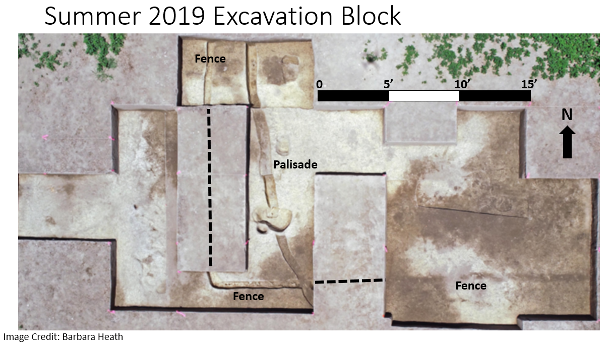
Geophysical work conducted by Dan Brock, myself, and Howard Cyr over the 2014-2020 fieldwork seasons helped identify the presence of several historical features on the Coan Hall site. The focus of the GPR and gradiometer surveys that I conducted in 2018 and 2019 was the identification of a circular palisade feature that had been identified in previous test unit excavations. Excavations in 2019 identified rectilinear English fence line that intersects the southwestern portion of the palisade (see image below).


